FEMA Flood Maps Expose Flood Risks for Camps: A Washington Post Analysis
Jul 8, 2025
 United States
Environmental Risk & Disaster Management
United States
Environmental Risk & Disaster Management
United States
Environmental Risk & Disaster Management
The Washington Post's analysis shows FEMA flood maps expose significant flood risks for camps, raising concerns about safety and preparedness.
FEMA Flood Maps Expose Flood Risks for Camps
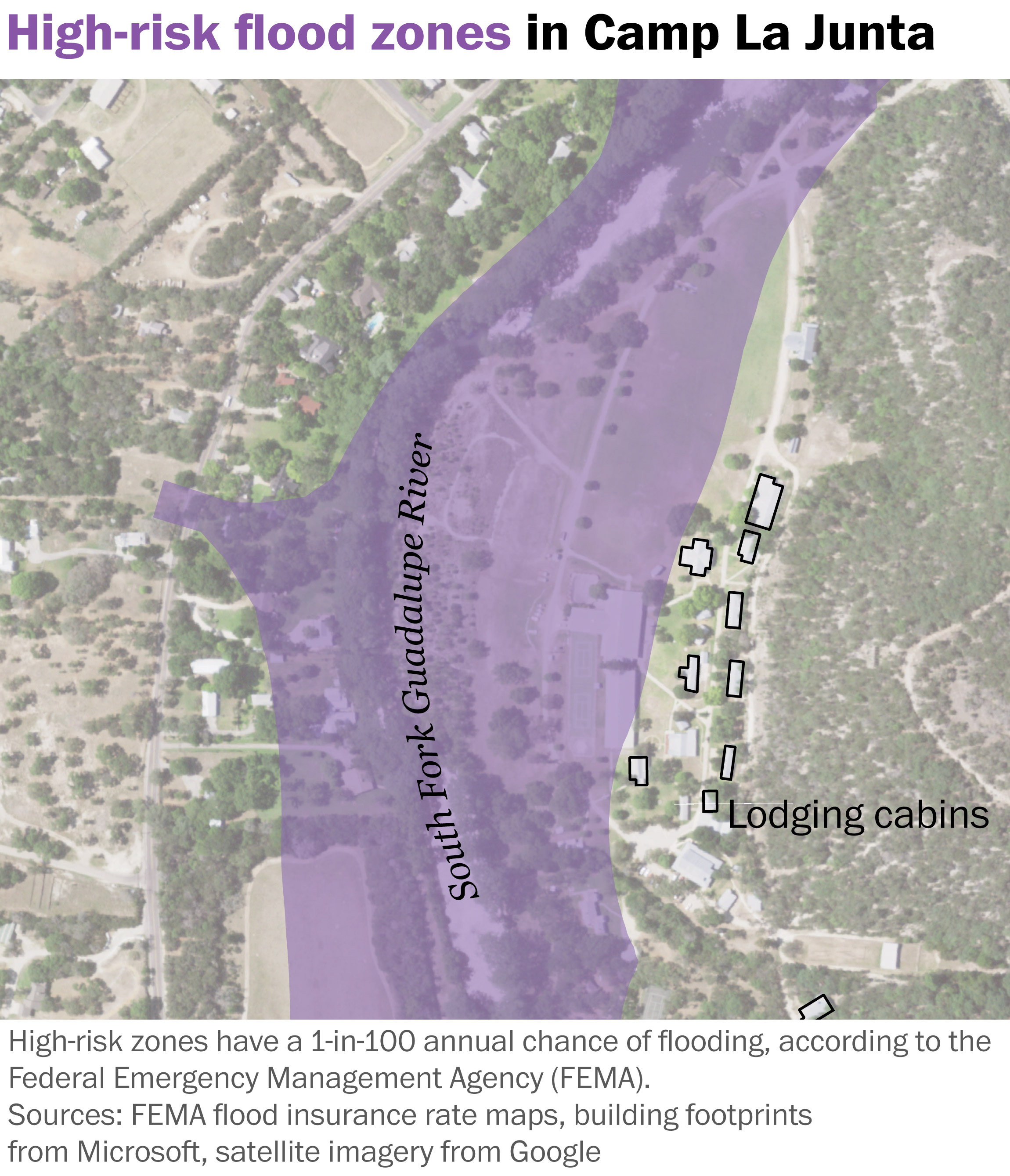
A recent analysis by The Washington Post reveals that FEMA's flood maps highlight significant flood risks for various camps.
These maps, designed to identify areas prone to flooding, indicate that many camps are located in zones with a high probability of inundation.
This raises concerns about the safety and preparedness of these facilities, particularly for vulnerable populations.
The analysis underscores the importance of understanding and utilizing FEMA's data to assess and mitigate flood-related risks for camps and similar establishments.
By news
4 days ago