
Devastating Floods Engulf Indonesia's Sumatra: Satellite Imagery Reveals Scale of Catastrophe
Recent satellite imagery has starkly revealed the severe and widespread flooding that has plagued multiple provinces across Sumatra, Indonesia's westernmost island. Triggered by relentless heavy rainfall, these devastating floods have tragically claimed the lives of at least 867 individuals. The scale of the destruction is immense, with numerous communities now grappling with widespread damage, displacement, and the urgent need for humanitarian aid.
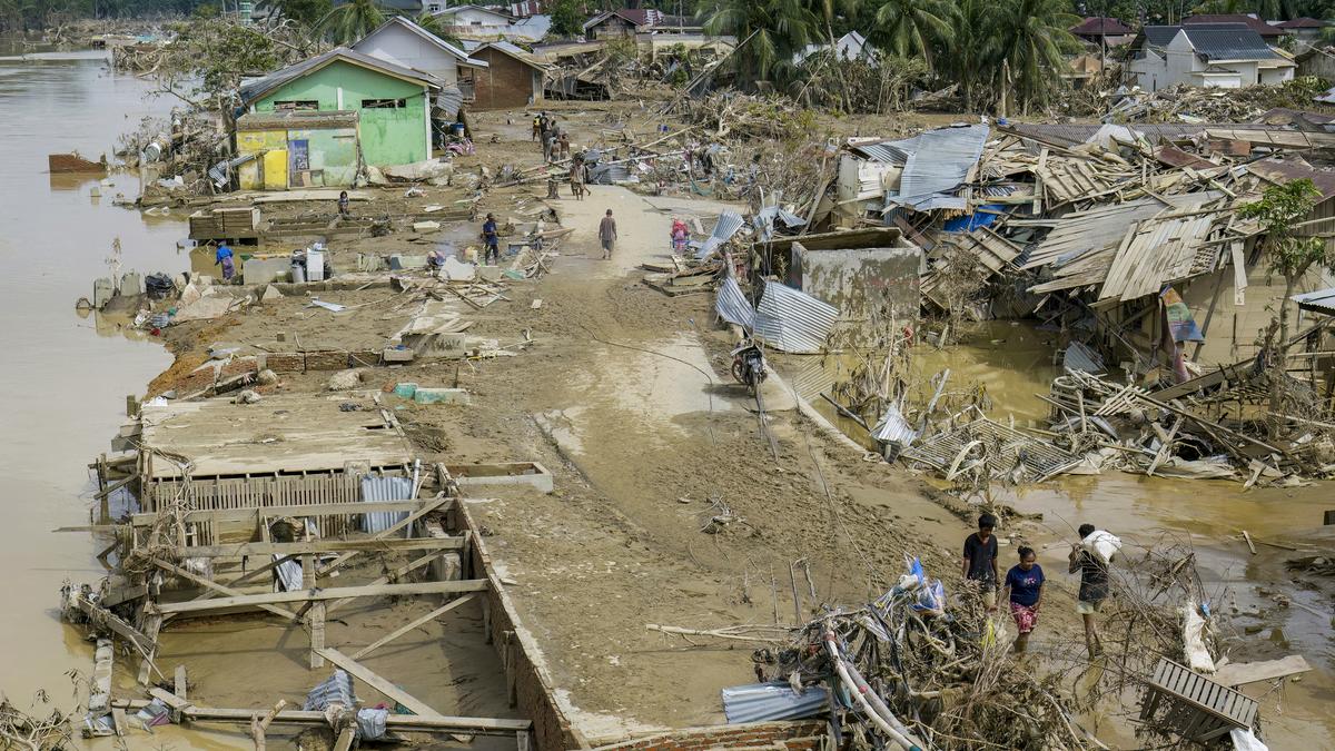
Kuala Simpang Among Hardest Hit Areas
Among the particularly affected regions is Kuala Simpang village in Aceh Tamiang, North Sumatra. Visual evidence, including photographs taken on December 2, 2025, vividly illustrates homes ravaged by the powerful floodwaters, underscoring the immediate and dire impact on its residents. This catastrophe highlights the ongoing vulnerability of regions prone to extreme weather events, necessitating urgent relief efforts and comprehensive long-term resilience strategies to protect communities from future incidents.
Ongoing Relief and Recovery Efforts
As rescue and recovery operations continue across the affected provinces, the primary focus remains steadfastly on assisting those impacted by the disaster and mitigating any further risks. Updated reports from December 5, 2025, consistently reiterate the critical situation on the ground, emphasizing the profound need for sustained support and resources to facilitate the monumental task of rebuilding and recovering from this significant natural calamity.