
Cyclone Ditwah Unleashes Devastation: Colombo Submerged, Satellite Imagery Reveals Full Extent
The island nation of Sri Lanka is reeling from the catastrophic impact of Cyclone Ditwah, which has left a trail of widespread destruction, particularly evident in the capital city of Colombo. Striking satellite images provide a grim, aerial overview of the devastation, confirming extensive flooding across the region.
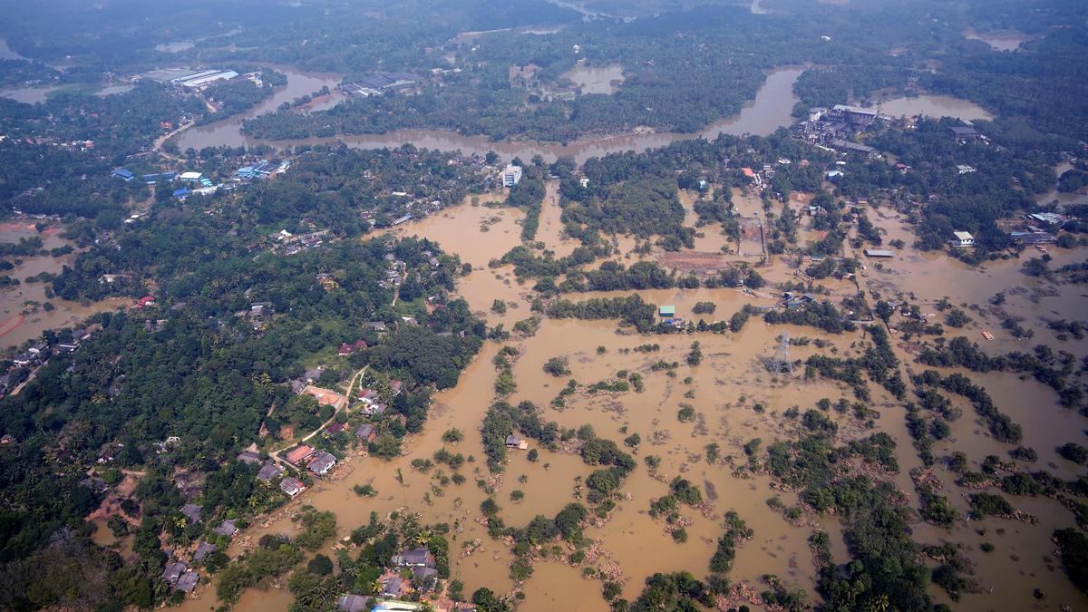
Unprecedented Flooding Captured from Above
As captured on December 2, 2025, these critical aerial photographs reveal numerous submerged buildings in areas such as Niyamgamdora. The visuals powerfully illustrate the sheer magnitude of the deluge caused by intense rainfall that accompanied Cyclone Ditwah, transforming urban landscapes into vast expanses of water.
Reports published on December 3, 2025, continue to paint a somber picture. The human cost of this natural disaster is profoundly tragic, with authorities confirming that the cyclone has tragically claimed the lives of at least 474 Sri Lankans. Communities are now grappling with immense loss, extensive property damage, and the arduous task of recovery.
Sri Lanka's Road to Recovery
Emergency services and humanitarian organizations are intensifying their relief efforts to assist those affected. This catastrophe serves as a stark reminder of the region's susceptibility to extreme weather phenomena and highlights the urgent necessity for enhanced disaster preparedness and resilience measures. The satellite imagery not only documents the scale of the disaster but also acts as a poignant testament to the formidable power of nature and the significant challenges that lie ahead for Sri Lanka in the wake of this destructive event.