Arctic Blast Plunges Central & Eastern US into Record-Breaking Cold
The United States is experiencing an unprecedented early winter chill, as a powerful Arctic air mass enveloped vast swathes of the central and eastern regions on December 5, 2025. This deep freeze brought sub-freezing temperatures significantly below seasonal averages, shattering records from Iowa to Michigan and New York.
Understanding the Phenomenon Behind the Chill
According to Marc Chenard, a meteorologist at the US Weather Prediction Center, this frigid weather pattern is a direct result of a fluctuation in the polar vortex. This atmospheric circulation system has drawn icy air directly from Canada, ushering it into the northern tier of the US. Temperatures have plummeted as much as 20°F (6.6°C) below average, an intensity typically seen deeper into the winter season. The cold snap, which commenced on December 4, is anticipated to persist in waves over the next one to two weeks, marking it as the most extensive and intense cold period of the season so far, despite winter being more than two weeks away.
Record-Breaking Lows Sweep Across the Nation
The extreme cold stretched from the northern Plains, through the Great Lakes and Ohio Valley, extending into the mid-Atlantic and New England. Even the South-east is projected to experience colder-than-normal temperatures, though still above freezing.
Several areas registered new all-time low temperatures:
- Iowa: On December 4, over a dozen locations in Iowa, Wisconsin, and Minnesota reported new benchmark lows. Spencer, Iowa, recorded a staggering -19°F (-28.3°C), a full 10 degrees colder than its 2005 record of -9°F.
- Michigan: Detroit hit a new low of 5°F (-15°C) on the morning of December 5, surpassing its previous record by one degree.
- New York: John F. Kennedy and LaGuardia airports in New York City both registered 20°F (-6.6°C), either setting or tying their historical lows. Upstate New York saw an even more dramatic drop to -22°F (-30°C), breaking its previous record of -20°F.
Hazardous Conditions and Further Outlook
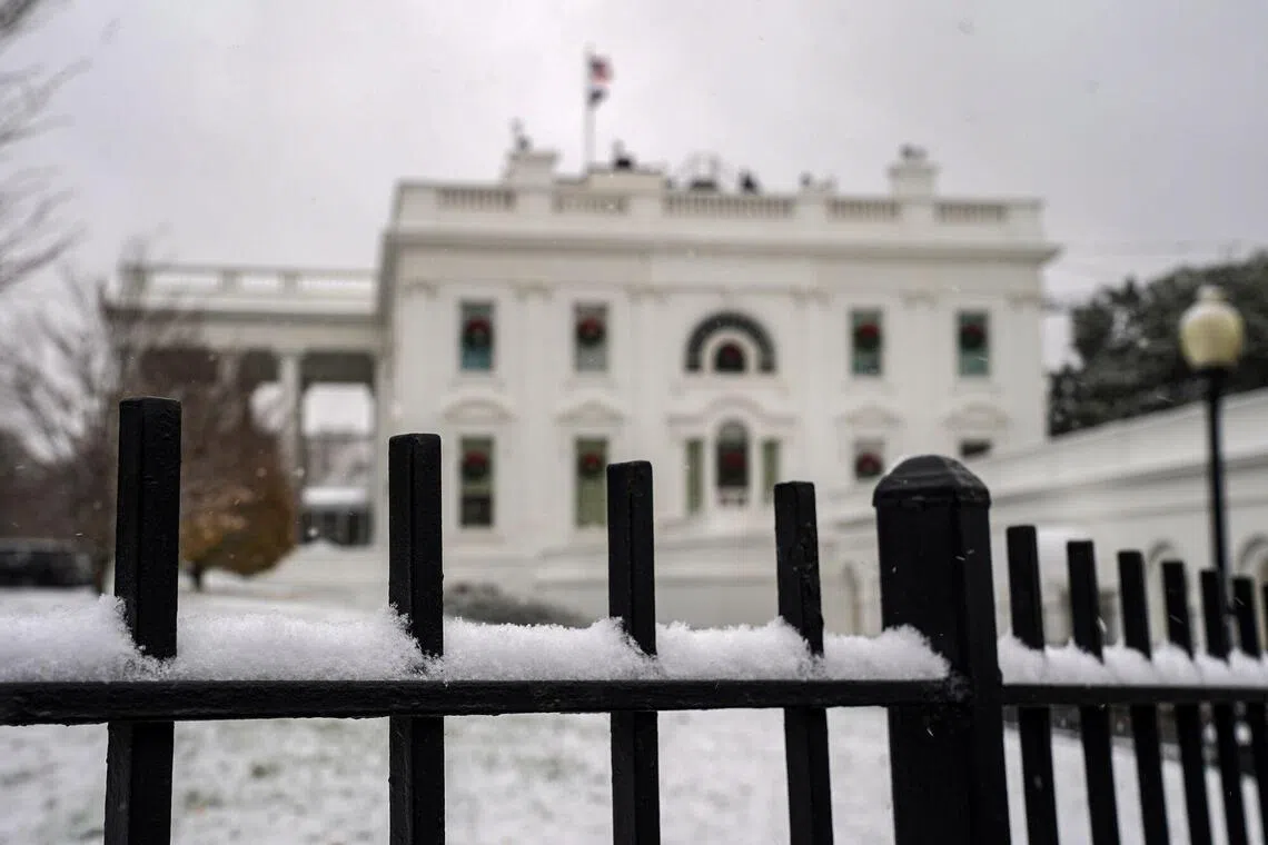
Local forecasts in Indiana and Oklahoma warned of freezing fog, a dangerous condition where super-cooled water droplets can freeze on surfaces, leading to treacherous black ice. Beyond the frigid temperatures, snow is also expected across parts of the mid-Atlantic, Midwest, and Rockies through December 6. The National Weather Service anticipates heavy snow in the northern Plains and Midwest due to a storm system crossing the region on Saturday. The White House in Washington DC itself was set to experience temperatures near -7°C after sunset on December 5.